Real-time, terrain mapping for bore planning
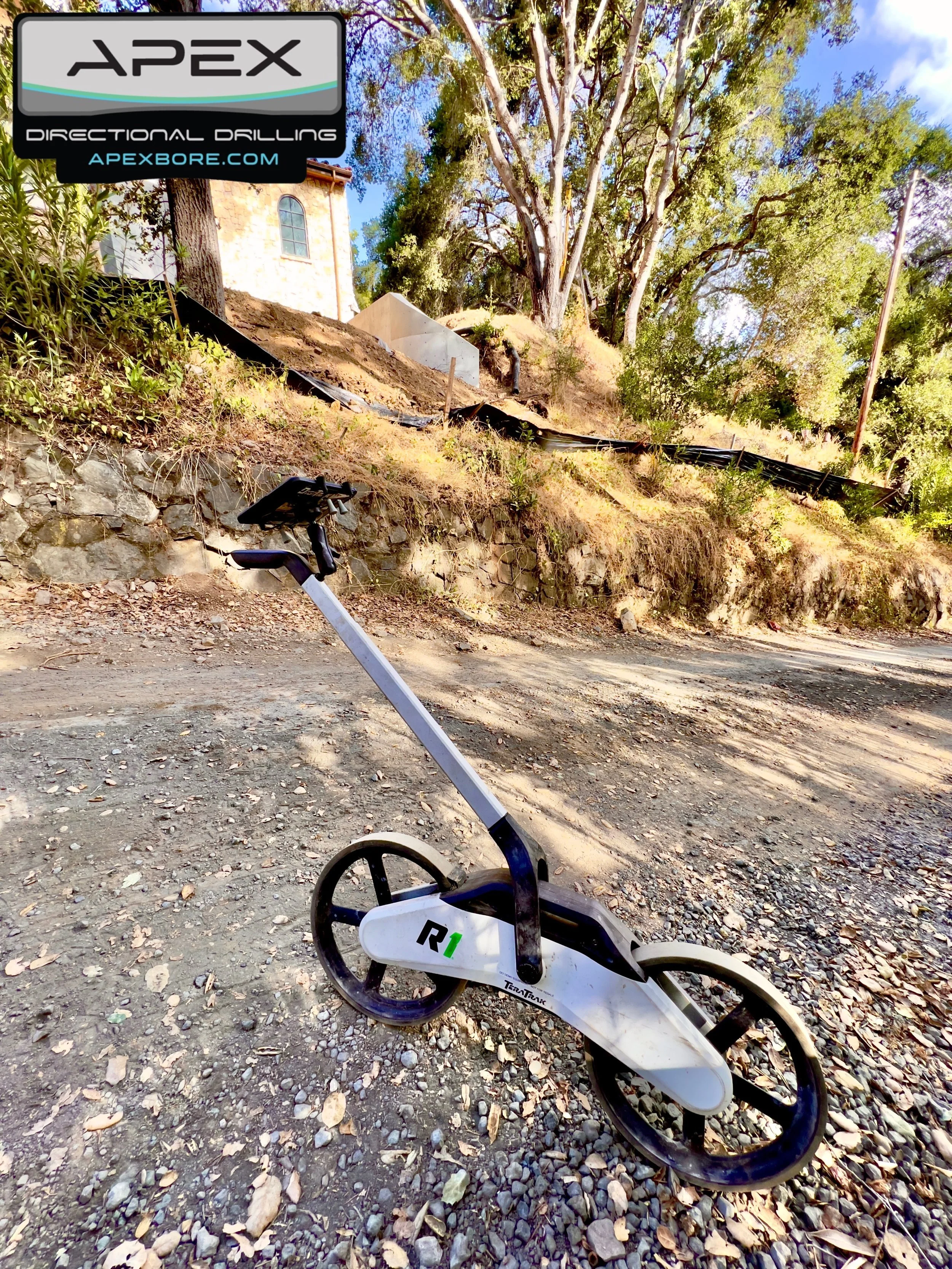
Apex Directional Drilling utilizes the latest technology in bore planning by incorporating advanced topography GPS equipment. One of the key tools in their arsenal is the DCI R1, a high-precision GPS device designed for accurate and efficient mapping of bore paths. This cutting-edge equipment enables Apex to gather precise topographical data, ensuring optimal planning and execution of directional drilling projects. By leveraging the R1’s capabilities, they enhance accuracy, reduce potential errors, and improve overall project efficiency, reinforcing their commitment to innovation and excellence in the industry.
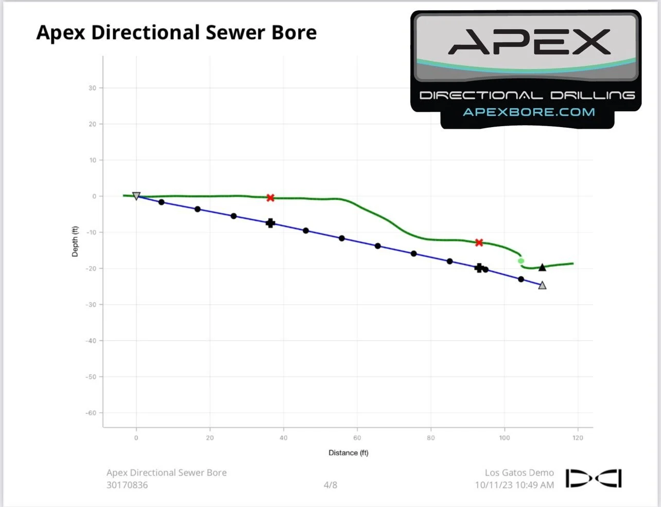
First of its kind, the DCI TeraTrak R1 is a real-time, terrain mapping tool for horizontal directional drilling. TeraTrak R1 easily creates continuous topography marked with utilities and waypoints, which previously used expensive survey methods. Used in conjunction with TeraTrak R1, an app is used to visualize underground hazards and the precise elevation and distance measurements along the drill path.
TeraTrak R1 addressed the following challenges: (a) a functional and easy-to-use device by anyone; (b) create a visually stunning product built to withstand the challenging environmental elements, combining robust, rugged materials and DCI’s brand language; and (c) seamless integration into the HDD workflow and DCI’s product suite, eliminating the need to deploy a separate survey crew for planning purposes.